Portland High Crash Network Data: How to Use It After a Street Injury
Portland High Crash Network Data: How to Use It After a Street Injury
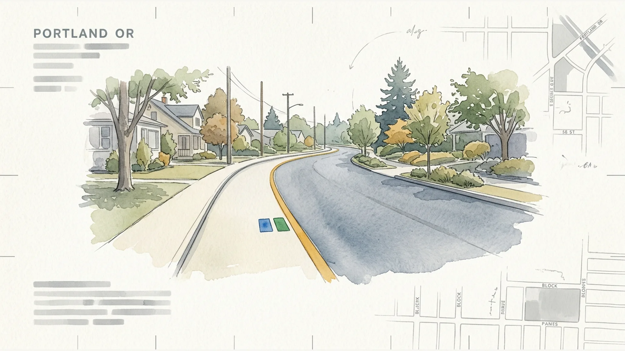
Portland’s High Crash Network can help an injured person ask more focused questions about a crash location. It may point toward prior reported crashes, the agency connected to a road, available speed studies, safety projects, design records, or evidence that should be identified quickly.
What it cannot do is prove a claim by itself. A High Crash Network designation, intersection rank, crash count, speed study, camera location, or later safety project is not a legal finding that a road was defective. It does not establish notice, negligence, causation, or which person or agency was responsible for a particular crash.
The most useful approach is to treat public data as a starting map: preserve what the source showed, identify its limits, and use it to request more specific records tied to the exact location, time, and crash mechanism.
What Portland’s High Crash Network Actually Shows
As of July 24, 2026, the Portland Bureau of Transportation (PBOT) identifies 30 high-crash streets and 30 high-crash intersections. PBOT says these locations make up 8% of Portland streets and accounted for an average 67% of traffic deaths from 2020 through 2024.
Those figures offer important citywide context, but the street list and intersection table are not the same kind of analysis:
- PBOT developed the 30-street network using crash data from 2004 through 2013. The selection combined top street lists for motor-vehicle, bicycle, and pedestrian crashes, using different severity criteria for those modes.
- The corridor charts displayed by PBOT as of July 24, 2026 report outcomes from 2017 through 2021.
- The current overall High Crash Intersection analysis uses crashes from 2020 through 2024.
- The average 67% concentration figure concerns traffic deaths from 2020 through 2024.
These time periods should not be blended. In particular, the 30-street list is not a new ranking based on 2020–2024 data.
A network label is not a negligence finding
The High Crash Network is useful for screening and transportation planning. Its value in an injury investigation is more limited and specific: it can flag a place for closer review and help identify records that may exist.
PBOT’s overall intersection rank is not simply a count of crashes. It combines crash count, crashes per million entering vehicles based on average daily entering traffic, and estimated comprehensive economic costs assigned by injury severity. PBOT also warns that underreporting means its table does not represent every collision.
The resulting rank does not identify why a crash happened. It does not establish a dangerous defect, show that an agency knew about the mechanism involved in a later collision, or prove that a roadway condition caused an injury. Those questions require location-specific evidence.
The date window changes what a number means
Public pages and metadata do not always update together. Older PBOT material may still display a 62% figure for earlier periods, while the current HCN summary reports an average 67% of traffic deaths for 2020–2024. A number without its date range can therefore be misleading even when it came from an official source.
Whenever you save or discuss HCN information, record:
- the years covered;
- the date you accessed the source;
- whether the number concerns streets, intersections, crashes, people, injuries, or deaths; and
- whether it is a raw count, an exposure-adjusted rate, or part of a composite rank.
That information makes the result more understandable and reproducible. It still does not turn a network statistic into proof of negligence in an individual case.
Start With the Exact Crash Point, Date, and Road Authority
A corridor-level label is broad. An investigation should begin with the exact part of the transportation system involved: the lane, intersection leg, ramp, bridge, sidewalk, crossing, signal, light, or other feature at issue.
The crash date matters too. Road geometry, signal operation, construction controls, markings, signs, and maintenance responsibilities can change. A current map may not show what existed when the crash occurred.
Ownership percentages are clues, not answers
PBOT reports that 82% of HCN streets are owned and operated by PBOT, 18% by the Oregon Department of Transportation (ODOT), and two bridges by Multnomah County. Those network-wide percentages do not determine who controlled a particular lane, ramp, signal, light, crossing, or maintenance function on the incident date.
Ownership, operation, maintenance, design authority, signal control, lighting, construction responsibility, and contractor duties may not all belong to the same entity. Use map ownership information as a lead, then confirm the allocation through incident-date records and agreements. Our companion guide explains why ODOT versus PBOT control matters at the exact location.
Preserve the incident-date configuration
Records that may help reconstruct the location include:
- as-built plans and later revisions;
- signal timing and operational records;
- construction plans and temporary traffic controls, including relevant event permits and temporary traffic-control plans;
- maintenance allocations and intergovernmental agreements;
- work orders and inspection records;
- applicable design guidance, calculations, warrants, and approved exceptions; and
- photographs or video showing the location near the incident date.
PBOT’s design materials draw from local, state, and national standards, use engineering judgment, and allow justified exceptions in constrained settings. Its Traffic Design Manual also distinguishes mandatory “shall” provisions from normal-practice “should” and optional “may” language.
That is why a current manual cannot, standing alone, establish the standard governing older work or prove that an earlier design was negligent. The relevant investigation concerns what was built, operated, and maintained at the time, along with the standards, approvals, and agreements then applicable.
Use Each Public Dataset to Ask a More Focused Question
Different public sources answer different preliminary questions. For each one, consider three things: what it can show, what it cannot show, and which underlying records it may help identify.
HCN maps and intersection tables: Is the location flagged, and under which method?
PortlandMaps’ public HCN street layer identifies mapped corridor extents and includes fields for motor-vehicle, bicycle, and pedestrian designations. Its metadata reports 30 line features and a July 23, 2026 dataset update. The High Crash Intersections layer reports 30 point features and fields that include fatality and injury-severity counts, injury costs, entering volume, collision rate, and rank; its metadata reports a February 25, 2026 dataset update.
These layers can help confirm how a public map categorizes a location. They are not a substitute for the underlying analysis. The street-layer metadata disclaims responsibility for errors, omissions, and positional accuracy. The intersection metadata also contains a field alias reading “Current Rank 2022,” even though PBOT’s current webpage describes a 2020–2024 intersection analysis.
For case-specific use, consider preserving the layer version and requesting the actual GIS export, data dictionary, intersection query, entering-volume source, and calculation files. A plotted line or point provides context; it does not prove the map is exact or that the mapped designation has any particular legal effect.
ODOT crash data: Are there earlier reported events worth examining?
PBOT relies on ODOT’s official crash record for most crash analysis. ODOT’s Crash Data Viewer offers the latest 10 years of published data and permits geographic and circumstance filters and downloads. That makes it useful for screening for earlier reported events near a location.
The search result must be interpreted carefully:
- ODOT’s data come from driver and police crash reports, and ODOT does not guarantee that every qualifying crash appears or that every detail is accurate.
- According to ODOT’s April 14, 2026 disclaimer, about 60% of crash-report packets for 2020–2024 included a police report.
- ODOT identifies underreporting concerns involving distraction, substance involvement, some bicycle collisions, and some hit-and-run information.
- Some events are excluded under the dataset’s reporting criteria, and mapped points may not align exactly with newer road linework.
- Map points can stack, and participant counts should not be mistaken for crash counts because one crash may involve multiple people.
PBOT says ODOT generally releases a complete calendar-year record 12 to 18 months after the year ends. Recent fatal-crash reporting may instead rely on preliminary Portland Police information that can change.
An ODOT result can identify an event worth investigating. An empty search does not prove that no prior crash, complaint, or hazard existed. The next step may be to obtain identifiable crash packets, police records, diagrams, crash IDs, or other source material and then compare the circumstances.
Speed counts and cameras: What conditions or short-lived evidence should be checked?
Portland’s public Traffic Speed Counts layer includes data such as posted speed, observed speed percentiles, percentages exceeding the posted speed, average daily traffic, direction, dates, duration, and conditions.
These counts are observations from a particular place and period. PBOT says pneumatic counts are usually conducted for 24 or 48 hours; speed counts cover one lane and may miss some slow or closely following vehicles. Location, lane, direction, season, weekday or weekend, construction, weather, and count date all affect how useful a result may be.
A speed count can describe observed traffic during the study. It is not continuous proof of corridor speed and does not prove how fast a particular driver was traveling during a later collision.
PBOT’s safety-camera page, updated July 24, 2026, says video not resulting in a citation is held for only 30 days and may be requested through the City’s public-records process. Prompt efforts to identify and preserve potentially relevant material may therefore matter. A camera’s presence, or the number of citations issued while it operated, does not prove what occurred in a specific crash. Citation totals also should not be compared across locations without information about exposure, enforcement thresholds, and camera uptime.
Projects and design sources: Which underlying agency files may exist?
PBOT reports that it and partner agencies invested $193 million in HCN safety projects since 2017. Project listings may help identify construction dates, design files, evaluations, and the agencies involved. PBOT also reported developing a “high injury analysis” in 2025 that divides the network into smaller segments and examines design infrastructure and alignment with agency guidance.
No public segment-level dataset or methodology for that 2025 analysis was located in the approved research completed July 24, 2026. A targeted request could seek its methodology, outputs, and version history where relevant.
Project spending, a later improvement, or a new analysis is not an admission that a road was legally defective or that work was required earlier. Current design guidance likewise does not prove what standard governed a facility when it was designed, rebuilt, or maintained. These public sources are most useful as leads to project evaluations, calculations, exception approvals, signal records, work orders, and decision files. For a closer look at that type of investigation, see the records behind a missing-sign or traffic-control theory.
Turn the Public Data Into Targeted Evidence Requests
A public map becomes more useful when it leads to a focused records plan. Availability, custody, retention, and relevance will depend on the location and date, and not every category below will exist in every matter.
A public-records request is a disclosure tool, not necessarily a preservation hold. Send it to the public body that actually has or controls the record, separately identify short-retention material for prompt preservation where appropriate, and do not assume that either step extends a claim-notice or filing deadline. A preservation request should not be described as creating an automatic legal duty or hold. Oregon law generally requires production only of existing, nonexempt public records; fees, estimates, prepayment, clarification, redactions, exemptions, and partial production may apply. Subject to statutory exceptions and suspensions, a public body generally must acknowledge a request within five business days and, no later than 10 business days after that acknowledgment deadline, complete the request or provide a written processing statement and reasonable estimated completion date. Those provisions do not guarantee production within 15 business days.
Crash-history and similarity records
Instead of relying on aggregate dots or totals, use the public data to identify records such as:
- ODOT crash packets and crash IDs;
- Portland Police reports and diagrams;
- source reports supporting coded database fields; and
- photographs, witness information, or other available records tied to screened events.
These materials may reveal whether an earlier event involved the same movement, mode, geometry, controls, or alleged condition. They may also show that a database point or code was too general to support a meaningful comparison.
Notice, operations, and maintenance records
Depending on the issue, a targeted request might seek:
- 311 complaints and service requests;
- prior claims, where obtainable;
- inspection histories, work orders, and maintenance logs;
- safety-camera records and signal logs;
- speed studies and project evaluations; and
- relevant agency communications.
The presence of a complaint or earlier crash does not automatically establish legal notice. The investigation still must ask what information reached the entity responsible for the relevant feature, when it arrived, and whether it concerned a substantially similar condition. Our article on road-maintenance history and prior-notice evidence discusses that distinction in a maintenance setting.
Design, project, and decision records
Potentially relevant design and decision materials include:
- as-built plans and change history;
- the manuals and standards applicable at the relevant time;
- engineering calculations and warrants;
- approved design exceptions;
- project evaluations and construction files;
- agreements allocating responsibilities; and
- records showing whether an authorized policy decision was made and how it was implemented.
These records may help distinguish the challenged conduct and identify whether a governmental policy judgment was exercised under delegated authority. The public HCN designation cannot make that distinction on its own, and requesting a decision file is not the same as proving that an actionable error occurred.
Screen Prior Crashes for Substantial Similarity
A corridor may contain many different collision patterns. Before treating prior events as useful to a notice or foreseeability theory, compare:
- the precise location;
- the crash mechanism and vehicle or road-user movements;
- travel mode;
- road geometry and traffic controls;
- lighting and visibility;
- weather and time; and
- road condition.
Oregon decisions recognize that substantially similar prior occurrences may, depending on the circumstances, be relevant to a continuing dangerous condition, its character, or notice. They do not make a corridor-wide crash total self-proving. Similarity and legal use remain context-dependent, and prior-occurrence evidence ordinarily is not a shortcut for proving the specific negligent act alleged in the later event.
Evidentiary use is a separate question from investigative usefulness. OEC 407 generally bars a post-event remedial measure when offered to prove negligence or culpable conduct, although another purpose such as controverted ownership, control, feasibility, or impeachment may be considered; those possible uses do not make admission automatic. A later report or investigation is not automatically a remedial measure, but it still needs an independent basis for admission. Public webpages, GIS exports, aggregate tables, reports, and screenshots also are not automatically admissible: relevance, substantial similarity, OEC 403, hearsay within hearsay, authentication, and foundation may all matter. Substantially similar prior occurrences may support limited issues such as a continuing dangerous condition or notice, but city data do not by themselves prove liability.
A mechanism-specific investigation therefore asks more than “Were there crashes on this street?” It asks whether earlier events involved the same alleged hazard under meaningfully similar circumstances. A Portland right-hook case, for example, calls for attention to turning movement, bicycle travel, sightlines, controls, and location-specific design—not just a corridor total. See how location-specific design evidence is used in a Portland right-hook investigation.
Ask what the responsible entity knew—and when
Finding an earlier coded crash is only one step. A notice inquiry also asks whether the correct entity received usable information about the relevant hazard before the later event.
In Rader v. Gibbons & Reed Co., the Oregon Supreme Court discussed the use and limits of substantially similar prior occurrences. In Little v. Wimmer, the court concluded that evidence of multiple earlier crashes at or near an intersection created factual questions about foreseeability and the reasonableness of failing to remedy or warn. Little also addressed the need for evidence of an actual delegated policy judgment when discretionary immunity is asserted, rather than treating a continuing non-decision as enough.
Neither decision means that every prior crash establishes notice, negligence, or liability. The mechanism, similarity, entity responsibility, information available, decision record, pleaded theory, evidentiary rules, and defenses all matter.
Save a Reproducible Snapshot of What You Found
Public datasets and webpages change. Preserve enough information for another person to understand and, if possible, repeat the search:
- query and access date;
- dataset name and whether the data were initial, preliminary, or published;
- data years or vintage;
- geographic boundary or buffer;
- every filter used;
- whether the result counts crashes or participants;
- crash IDs;
- GIS layer version and metadata;
- screenshots; and
- downloaded exports in their original form.
A screenshot records what appeared on a screen. It is not the underlying crash report, GIS file, calculation workbook, or agency record. Preserve both the display and available exports, then seek source records where the issue warrants it.
Treat current data as a dated snapshot
ODOT distinguishes initial, preliminary, and published data. Published annual datasets are quality-controlled static snapshots, while initial fatal information can change or be removed if an event does not meet reporting criteria. PBOT and PortlandMaps pages may also carry different update dates or older field labels.
Use “as of” language for current source descriptions. Recheck webpage language, metadata, agency guidance, camera information, and applicable law before case-specific use. A later correction does not necessarily mean the earlier screenshot was false; it may mean the source was updated, recoded, or presented at a different publication stage.
Public-Body Issues Make Early Action Important
When a roadway investigation may involve PBOT, ODOT, Multnomah County, another public body, or a contractor, identifying the right entity affects record custody, claim routing, and legal analysis. Oregon public-body claims can involve discretionary immunity, special notice rules, designated recipients, separate action timing, possible statutes of ultimate repose, and other requirements.
Those issues cannot be resolved from an HCN map. They depend on the exact location, function, entity, dates, claim, and decision record.
A data entry or agency awareness is not necessarily claim notice
ORS 30.275 generally provides a 180-day notice period for public-body claims other than wrongful death and a one-year notice period for wrongful-death claims. The statute also contains detailed rules concerning the form and recipients of notice, actual notice, commencement of an action, and limited exceptions.
Separate from the notice periods, ORS 30.275(9) generally requires an OTCA action to be commenced within two years after the alleged loss or injury, subject to listed statutory exceptions, and that period generally governs public-body wrongful-death actions notwithstanding the ordinary ORS 30.020 period. Statutes of ultimate repose may independently affect older design or construction theories. Public-records requests, preservation efforts, or related records activity do not extend these periods, and no individual deadline should be calculated without claim-specific legal analysis.
A police report, 311 request, crash-data entry, or agency awareness of a corridor is not necessarily notice that a particular injured person intends to assert a claim. A City of Portland claim form also does not resolve whether notice must go to ODOT, Multnomah County, another entity, or a contractor. Prompt individualized analysis is important; our dedicated guide addresses Oregon public-body notice requirements.
Policy choices and operational records are not the same
ORS 30.265(6)(c) includes immunity for claims based on the performance or nonperformance of a discretionary function or duty. A potentially protected delegated policy judgment is not necessarily the same as operational implementation, maintenance, failure to carry out an adopted decision, or a continuing non-decision unsupported by evidence of such a judgment.
Those labels are not categorical outcomes: the immunity question is whether the challenged conduct embodies a governmental policy judgment exercised under delegated authority, and engineering or technical judgment alone is not necessarily protected discretion. The classification does not by itself establish that immunity applies, that immunity is unavailable, or that actionable fault occurred.
The distinction is fact-specific. HCN status does not resolve immunity in either direction. It can, however, help focus a request for the actual records showing who had authority, what was considered, what decision was made, and how that decision was implemented.
Frequently Asked Questions
Does being injured on a Portland High Crash Network street prove the road was unsafe or the City was negligent?
No. The designation is an investigation lead and planning tool. It does not prove a defect, notice, breach, causation, or responsibility for a particular crash. Location-specific evidence is still necessary, and the responsible entity may not be the City of Portland.
How current is Portland High Crash Network data?
It depends on the item. The 30-street network was developed from 2004–2013 data; corridor charts displayed as of July 24, 2026 show 2017–2021 outcomes; the current overall intersection analysis and average 67% death-concentration figure use 2020–2024 data. PortlandMaps metadata reports February 2026 updates for its HCN street and intersection layers. Always preserve the source, query date, date window, and version.
Can I use ODOT crash data to find earlier crashes at the same location?
Yes, as a screening tool for reported events. But the data are lagged, coded, incomplete, and subject to reporting and inclusion rules. Obtain source records when possible and compare the mechanism and conditions before treating events as substantially similar. No database result proves that an earlier event or hazard did—or did not—exist.
Is a public-records request the same as asking an agency to preserve evidence?
No. A public-records request seeks disclosure of existing, nonexempt records from the entity that has or controls them. It is not necessarily a preservation hold, and a separate preservation request should not be described as automatically creating a legal duty or hold. Neither records requests nor preservation efforts extend OTCA notice or action periods.
What records can public crash or roadway data help me request?
Depending on the lead, requests may target crash packets, police reports, complaints, work orders, inspection and maintenance records, speed studies, camera video, signal logs, as-built plans, calculations, approved exceptions, project evaluations, communications, and agreements allocating responsibility. Not every record will exist or be available, and none proves a claim merely by existing.
How do I know whether PBOT, ODOT, or Multnomah County controlled the crash location?
Use public ownership information as an initial clue, then confirm incident-date responsibility for the exact lane, intersection leg, ramp, bridge, signal, light, crossing, or maintenance function. Ownership and operational responsibilities can be divided among entities or contractors.
Do special deadlines apply if a Portland street injury may involve a public body?
Potentially. Oregon public-body claims have special notice, recipient, and action-filing rules, and statutes of ultimate repose may affect some older design or construction theories. A police report, public-data entry, complaint, records request, preservation effort, or agency knowledge about a corridor is not necessarily claim notice and does not extend a deadline. Because the correct analysis depends on the facts and dates, prompt individualized legal review is important.
The Bottom Line: Use the Data to Find Evidence, Not to Skip the Proof
Portland’s High Crash Network, ODOT crash records, speed counts, camera information, project pages, and design sources can focus an investigation. They can help identify questions about similar incidents, agency control, notice, roadway context, design history, short-retention evidence, and records worth requesting.
They remain context and investigative leads—not findings that a public body or anyone else was negligent. A claimant still must prove every required element and address applicable defenses with evidence tied to the actual collision.
If a public body may be involved, or potentially relevant camera video may be subject to a short retention period, prompt review can help identify the right entities, distinguish disclosure from preservation, and avoid relying on a public map for answers it cannot provide.
This article provides general educational information only and is not legal advice. Laws, agency responsibilities, datasets, evidentiary rules, immunities, and deadlines can change, and their application depends on the specific facts.
Sources
- Portland Bureau of Transportation, High Crash Network streets and intersections, current page reviewed July 24, 2026.
- Portland Bureau of Transportation, Vision Zero data and Guide to the Vision Zero dashboard.
- Portland Bureau of Transportation, Speed and intersection safety cameras, page updated and reviewed July 24, 2026.
- ODOT Crash Analysis and Reporting Unit, ODOT Crash Data Disclaimers, dated April 14, 2026, and Crash Data Viewer User Guide.
- City of Portland Corporate GIS, High Crash Network metadata, High Crash Intersections metadata, and Traffic Speed Counts.
- Portland Bureau of Transportation, Traffic Counts, Traffic Design Manual—Permanent Traffic Control and Design, Civil Design Guide for Public Street Improvements, and Annual Vision Zero Action Plan Progress Report.
- Oregon Legislative Assembly, ORS chapter 192, including ORS 192.314, 192.324, 192.329, and 192.338.
- Oregon Legislative Assembly, ORS chapter 40, including OEC 407/ORS 40.185.
- Oregon Legislative Assembly, ORS chapter 30, including ORS 30.265 and ORS 30.275, and the 2026 Volume 1 update table.
- Oregon Department of Justice, 2024 Attorney General’s Public Records and Meetings Manual.
- Rader v. Gibbons & Reed Co., 261 Or 354, 494 P2d 412 (1972), and Little v. Wimmer, 303 Or 580, 739 P2d 564 (1987).
- City of Portland Risk Management, File a claim against the City. Agency guidance does not replace statutory or location-specific analysis.
Client-First Fee Promise
Client First = Bills First, Fees Second
Your unpaid medical bills do not have to make your lawyer's fee bigger. Johnson Law subtracts qualifying medical bills before calculating our fee, helping clients keep more of their settlement.
Applies to qualifying cases. Results vary.